Thursday, November 10, 2016

pizza like the earth?

A piece of pizza can be used in order to model the layers of the earth! At first you may think no way- but just like the earth, a pizza slice has many layers. Each layer pf the pizza represents a part of the earth

with my particular slice of pizza- cheese- it is difficult to make the comparison because there are not enough layers to the pizza to represent each layer of the earth so I am going to be figurative and imagine a extra cheese with peppers, pepperoni, chicken and garlic salt.- my favorite :)

the inner core = pizza crust
outer core= first layer of pizza sauce
the lower mantle = the first layer of cheese
upper mantle= extra cheese of a different type
the asthenosphere= the pepperoni
lithosphere=the peppers
continental crust= chicken
oceanic crust= Parmesan/ garlic salt


any way you look at the layers its a delicious model!! all the pieces go together in order to create one big beautiful thing! pizza or the earth!

Tuesday, November 8, 2016

peanut butter boundary lines

we created an example of what different plate tectonics may look like. we used graham crackers and peanut butter in order to show plate action.
Plate actions—can come together, go apart, or slide past each other
Boundaries—convergent, divergent, transform fault
Where the mountains are tell us what direction the continent is moving ie: rocky mountains on west mean we are moving west, south American Andes on east means they are moving east, Himalayan in India show movement as well
              Continental interaction
Graham cracker activity: showing how the mountains show movement through pushing them down into peanut butter.
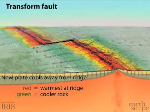
1)      Transform fault
a.      
2)      Divergent boundary
a.       Frosting doll-up and put in center of wax paper—put the two pieces of cracker back together and slide down then pushed out
b.     
 

3)      Convergent

a.       Like the rug bunching up when shoved against the wall. 

image found at http://interactivesciencenotebook.weebly.com/convergent-boundary.html

with this lab we were able to physically form the ranges. 

peanut butter boundary lines

we created an example of what different plate tectonics may look like. we used graham crackers and peanut butter in order to show plate action.
Plate actions—can come together, go apart, or slide past each other
Boundaries—convergent, divergent, transform fault
Where the mountains are tell us what direction the continent is moving ie: rocky mountains on west mean we are moving west, south American Andes on east means they are moving east, Himalayan in India show movement as well
              Continental interaction
Graham cracker activity: showing how the mountains show movement through pushing them down into peanut butter.
1)      Transform fault
a.      
2)      Divergent boundary
a.       Frosting doll-up and put in center of wax paper—put the two pieces of cracker back together and slide down then pushed out
b.     
 

3)      Convergent

a.       Like the rug bunching up when shoved against the wall. 

image found at http://interactivesciencenotebook.weebly.com/convergent-boundary.html

with this lab we were able to physically form the ranges. 

Tuesday, November 1, 2016

if I had $100 water edition

If I had $100  to distribute to the water in the world I have to figure out where to put the money to represent accordingly. I think that I would put about $80 to all the oceans in the world. I would put $5 into the smaller salt-water bodies. for glaciers and icecaps I would give $10. For lakes/rivers/ and streams I would give $2.50. for groundwater I would give $2. for atmosphere I would give 50 cents.

Real answers: I way overestimated the amount of freshwater we have available on earth. Only 3% of earths water is fresh. 97% is ocean water. for the 3% the break apart is 69% glacier, 30% groundwater, and less than 1% in lakes rivers and streams.

$96.50 oceans
$1.74 icecaps
$1.69 groundwater
$0.022 permafrost
$0.007 fresh water lakes
$0.006 salt water lakes and seas
$0.001 soil moisture
$0.001 atmosphere

Project wet

what is it: an educational mission that is focused on the importance of water awareness. They publish materials on water that is appropriate for a variety of age groups. the project is a collection of activities for hands on learning. It is a collection of resources for teachers to use.

Water Education for Teachers

Tuesday, October 18, 2016

Intro to rocks day : models represent something real

We have been give a rice Krispie treat, a piece of peanut brittle and a butterfinger to look at. Each one of these candies can be a model when looking at the rock cycle.

identifying a rock. the first step is to put it into one of the three major rock groups, igneous, sedimentary, or metamorphic. Each group of rock has its own information chart to look at in more detail. You look at the rock and compare it to an information chart in order to identify characteristics of the rock. Something that would help with identification is if you add pictures in order to have a comparison to visually look at.

So the butterfinger represents a igneous rock because it has different textures inside of it. it also varies in color depending on what part of the candy you are looking at.


the peanut brittle represents a sedimentary rock. I say this because it has bits of pieces formed together to make one larger piece. The peanuts show the different bits.


the rice krispie shows a metamorphic rock. It is sort of layered and it was formed through heat, and pressure then cooling together.

Friday, October 7, 2016

Rock field trip

Marquette is filled with all sorts of beautiful rocks. I have always loved driving through town and seeing the beautiful rock formations. This week we went on a field trip to go an explore these rocks, and we talked about the history behind them. We went to three locations: Near the welcome center, tourist park, and finally presque isle.

At the rock wall across from the welcome center we climbed up to see a rock formation that proves there was ocean life as it is covered in fossils of cynael bacteria algae. We can do relative dating based on this evidence to tell how old the rock is approximately.
In the rocks were evidence of inclusion from the different colored rocks that were blended together


the second location we stopped was at tourist parks. at this location we saw evidence of glacier activity. there were different levels of rocks, and gouges through the rocks to prove the glacier activity. There were different color rocks showing at least two levels of rocks visible showing a different age to those rocks based on the law of superposition . The explanation I liked the most from this stop was the rocks acting a bit like a lava lamp- rocks moving up and solidifying after they cool down. We cant tell the exact age from these rocks because they are not igneous rocks, but again we can do approximate dating.


the third spot we stopped at was presque isle and we saw the sandstone on the beach one of the oldest rocks around here. unfortunately we didn't get to see the blackrocks this time around but they are also a great example of ages of rocks, based on how they ended up in their location. When looking at this location it was easy to spot when there was a different type of rock present because the sandstone was everywhere. However, there were still some samples of younger rocks such as the green stone, as well as some layering seen in the cliff-face.